Image · Nano Banana
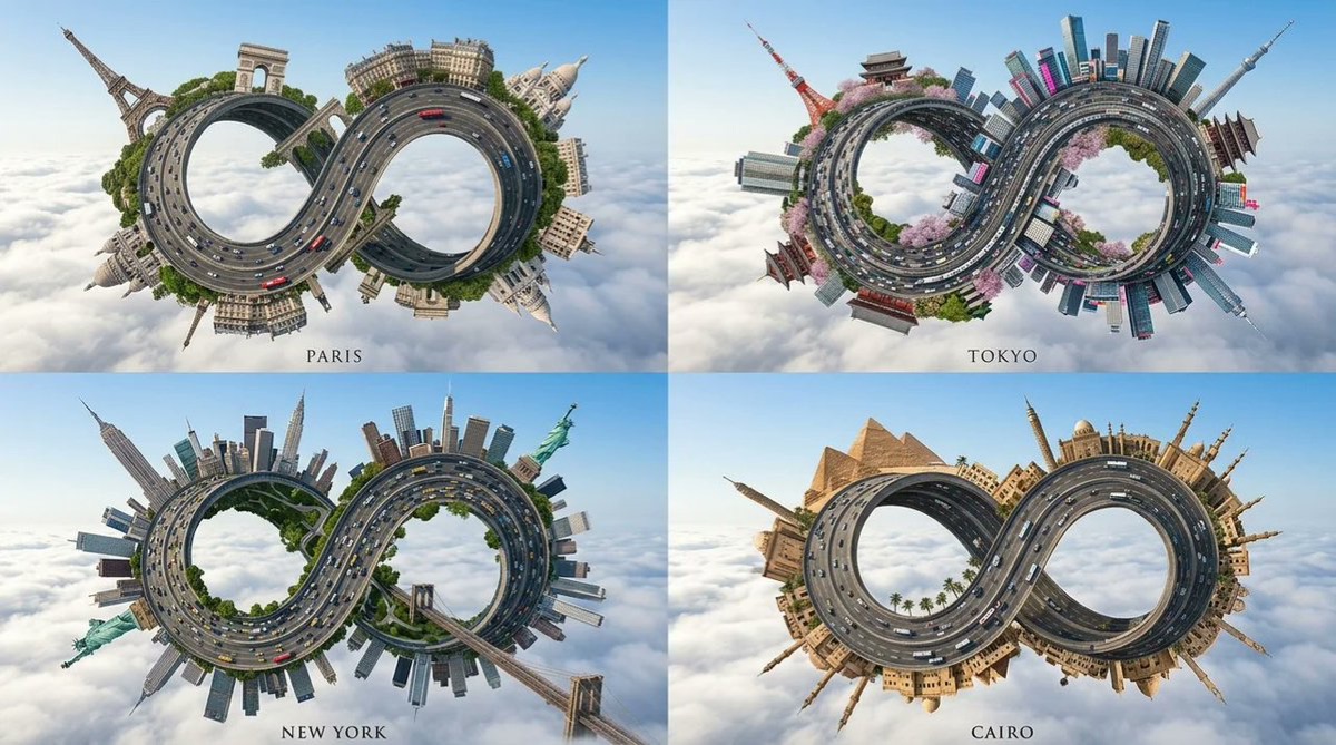
Aerial view of a floating infinity-loop city
Rebuild the roads, landmarks, and public transit of a specified international city as a huge, twisted loop city floating above a sea of clouds, creating a surreal aerial view.
 Gadgetify@Gdgtify
Prompt
2x2 grid, 16:9, do this for 4 international cities, A hyper-realistic extreme aerial photograph of [CITY_NAME] floating in the sky::3
Structure: The city's main multi-lane highway is warped into a colossal, continuous, twisted vertical loop (like a mobius strip) swooping into the foreground::5
Architecture: Inferred iconic monuments, historic buildings, trees, and local buses of [CITY_NAME] are built along all curving surfaces of the loop, defying gravity by pointing outward from the road::4
Environment: The entire structure floats above a vast, endless sea of thick, fluffy white clouds. Clear blue sky, bright morning sunlight, sharp focus::4
Flat ground, normal horizon, dirt, ocean water, 2d illustration, messy::-2
2x2 grid, 16:9, do this for 4 international cities, A hyper-realistic extreme aerial photograph of [CITY_NAME] floating in the sky::3
Structure: The city's main multi-lane highway is warped into a colossal, continuous, twisted vertical loop (like a mobius strip) swooping into the foreground::5
Architecture: Inferred iconic monuments, historic buildings, trees, and local buses of [CITY_NAME] are built along all curving surfaces of the loop, defying gravity by pointing outward from the road::4
Environment: The entire structure floats above a vast, endless sea of thick, fluffy white clouds. Clear blue sky, bright morning sunlight, sharp focus::4
Flat ground, normal horizon, dirt, ocean water, 2d illustration, messy::-2
How to use
Usage tip: Replace [CITY_NAME] with the target city and try versions for four cities in an image-generation tool that supports weighting syntax; after generating, check whether the landmarks, roads, and bus elements make the city recognizable enough.